Know what the sea will feel like, and when to go.
Sailor Co-Pilot reads the marine forecast, the tidal currents and the buoys for your route, then tells you the best time to leave, leg by leg, for your boat, and why.
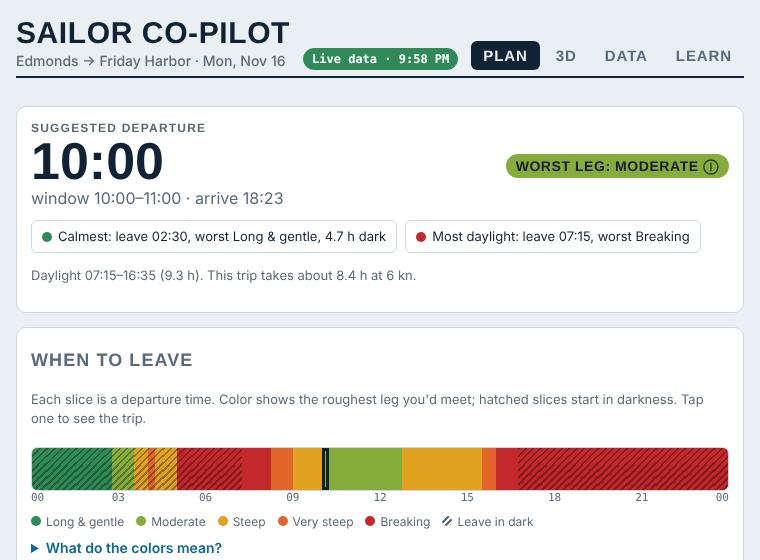
Every departure time, every leg, rated
The app sails your route for every possible departure time from midnight to midnight. At each leg it reads the wind, the local sea and the current at that moment, and colors the day from long and gentle to breaking.
Tap a time to see the whole trip. It also tells you when a passage won't fit in the daylight.
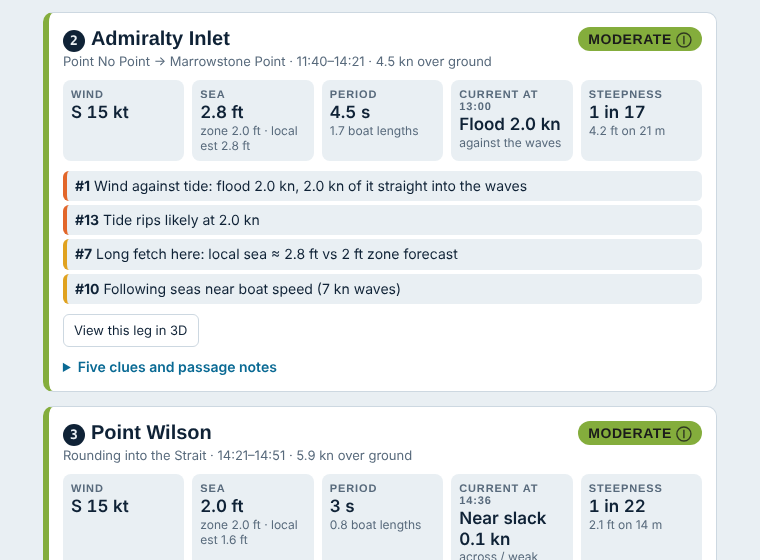
See why one meter can be a nice day or a day to stay in
A forecast height is only part of the story. Period, fetch, how long the wind has blown, swell from elsewhere, and a current running into the waves can turn a gentle sea into a steep one.
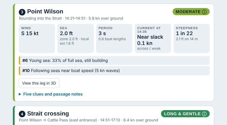
Sailor Co-Pilot flags these patterns on each leg, in plain words, so you learn to read the forecast yourself.
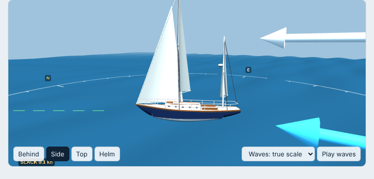
Your boat, in that leg's wind, waves and current
Pick a leg and watch your boat sail it: the waves at their real length and height, the current and wind drawn around a compass, the sails trimmed to the apparent wind.
The panel underneath explains everything relative to your bow: "flood 2.1 kn against you, running into the waves".
Three steps before you cast off
Chain your passages
Build your route from curated local passages, each with its forecast zone, current station and danger notes.
Live NOAA data
Forecasts, tidal currents and buoy swell are pulled in automatically and refreshed while the app is open.
Plan, and understand why
Get a departure window, a rating for every leg, and the reasons behind it.
Starting in Puget Sound and the San Juan Islands
Admiralty Inlet, Point Wilson, the Strait crossing, Cattle Pass, Rosario, Deception Pass and more are in the beta. Tell us your home waters below and we'll add the regions with the most sailors waiting.
Join the waitlist
Be first to try new regions and the full version. We'll only email you about Sailor Co-Pilot, and you can unsubscribe anytime.
You're on the list.
Thanks. We'll be in touch when new regions and the full version are ready. In the meantime, the beta is open: try it now.